Yesterday, I was talking with the folks at
Amtrak
(one of the sponsors of
45 Great Places To Go Bicycling
) about how to interact online with classes and school kids around the nation during the course of my bike trail journeys.
 When cell towers are nearby, cellphones are wonderful (I love my iPaq 6315 pictured to the right); however, trains and long distance bike trails in the USA & Canada can be so far from a cell tower that there is no signal available.
We discussed using satellite telephones to connect simultaneously via conference call to multiple schools (so teachers could use info from my trips realtime in their lesson plans & classes) as well as for uploading docs/photos from my laptop to the Internet.
Currently, I'm using
Flagr.com
to generate photo/description flags of notable locations on my trail routes. Flagr is very cool because it displays information laid over a
Google Map
; however, we also discussed the need for a system that records GPS waypoints. If such a system would allow me to note the exact position of something that I photographed or commented upon, teachers could use that information to bring more excitement to their Geography, Geology or History classes.
Although I'm pretty tech saavy and have used GPS equipment, I don't own a GPS device so I sought advice from an expert in this regard, Yury Gitman. Yury was responsible for the
MagicBike
project in Manhattan two years ago and regularly
blogs
about his bicycling journeys around the Big Apple. He uses a
Garmin Forerunner 301
and MotionBased to record and publish his bike routes onto static maps online. Yury suggested that I discuss my project with Garmin to see what hardware & software that they would recommend for my project.
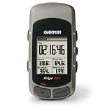 Clark at MotionBased was very helpful, suggesting use of either the
Garmin Edge 305
(pictured right) or
eTrex
gps devices. Waypoint data can be uploaded to the MotionBased site. Html code of the maps created on
MotionBased
can be plugged directly into my webpages via a feature called
Viewports
. If I synchronize the timestamp on my camera with the time on my GPS, then I can know exactly where a picture was shot.
Clark at MotionBased was very helpful, suggesting use of either the
Garmin Edge 305
(pictured right) or
eTrex
gps devices. Waypoint data can be uploaded to the MotionBased site. Html code of the maps created on
MotionBased
can be plugged directly into my webpages via a feature called
Viewports
. If I synchronize the timestamp on my camera with the time on my GPS, then I can know exactly where a picture was shot.
Besides discussing GPS equipment, Clark also suggested solar power chargers from
Solio
and
Brunton
as a means of charging my electronic devices when I'm in remote locations in the field. I'll certainly be looking into that as well.
Thanks Yury & Clark for some great info.
LL